Region types
The region types available vary depending on the topic that has been selected. Some topics allow reporting at a more detailed level of geography than others.
Most of the region types used on this website come from the Australian Bureau of Statistics’ Australian Statistical Geography Standard (ASGS). Updated after every census, the ASGS is a framework of different region types designed for statistical analysis and reporting. Each region type has a set of regions that together cover all of Australia.
The main structure of the ASGS has region types with regions that reflect where people live. Regions are relatively small in densely populated parts of Australia and relatively big in less densely populated parts to even out the variation in population size between regions.
The Indigenous structure of the ASGS has region types with regions that reflect where Aboriginal and Torres Strait Islander (First Nations) people live. The sizes of the regions belonging to these region types depend on the density of the First Nations population.
Indigenous locations
Indigenous Locations (ILOCs) represent small First Nations communities (urban and rural) with a minimum population of 90 First Nations usual residents. An ILOC is an area designed to allow the release of statistics relating to First Nations people with a high level of spatial accuracy whilst maintaining the confidentiality of individuals. ILOCs are aggregates of one or more SA1s.
Example: Mangkurrupa is located within the Tanami Outstations ILOC.
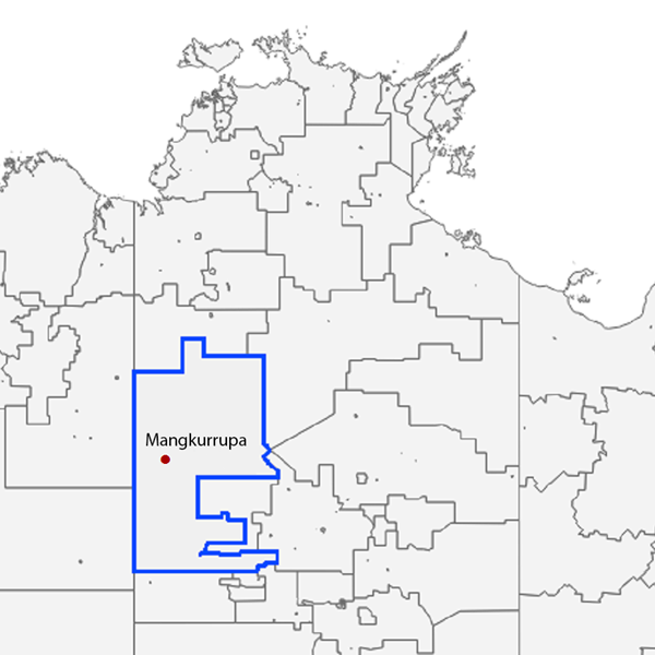
Indigenous Areas
Indigenous Areas (IAREs) are part of the ASGS’s Indigenous structure. With populations mostly ranging from a few hundred to a few thousand First Nations people, IAREs are medium-sized regions with populations that are large enough for the release of detailed statistics.
Example: Mangkurrupa is located within the Nyirripi and Tanami Outstations IARE.

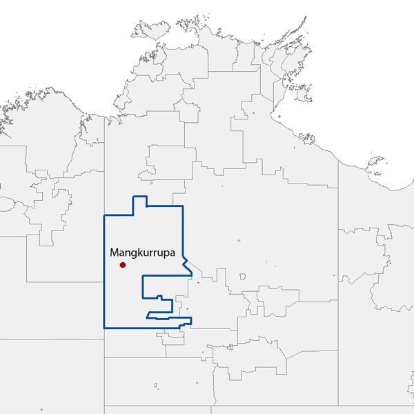
Indigenous Regions
Indigenous Regions (IREGs) are made up of whole IAREs and are also part of the ASGS’s Indigenous structure. IREGs are loosely based on the former Aboriginal and Torres Strait Islander Commission boundaries and have First Nations populations ranging from a few thousand up to about 85,000 people.
Example: Mangkurrupa is located within the Apatula IREG, which surrounds (but does not include) the small Alice Springs IREG.
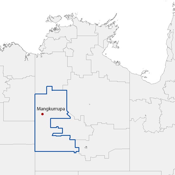
Statistical Areas Level 2
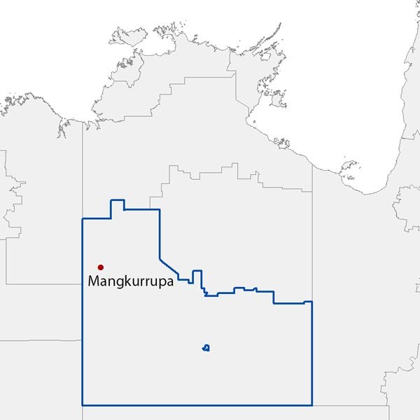
Statistical Areas Level 2 (SA2s) are part of the ASGS’s main structure. With populations generally ranging from 3,000 to 25,000 people, SA2s are designed to reflect communities that interact socially and economically.
Example: Mangkurrupa is located within the Tanami SA2.
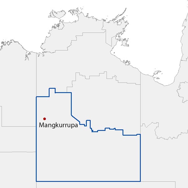
Statistical Areas Level 3
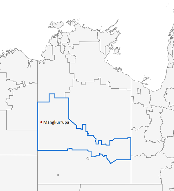
Statistical Areas Level 3 (SA3s) are made up of whole SA2s and are also part of the ASGS’s main structure. With populations generally ranging from 30,000 to 130,000 people, SA3s are typically clusters of related suburbs in larger cities, regional towns with surrounding areas or large regions in parts of Australia where there are no larger towns.
Example: Mangkurrupa is located within the Alice Springs SA3.
Statistical Areas Level 4
Statistical Areas Level 4 (SA4s) are specifically designed for the output of Labour Force Survey data and reflect labour markets within each State and Territory within the population limits imposed by the Labour Force Survey sample. Most SA4s have a population above 100,000 persons to provide sufficient sample size for Labour Force estimates. In regional areas, SA4s tend to have lower populations (100,000 to 300,000). In metropolitan areas, the SA4s tend to have larger populations (300,000 to 500,000). SA4s are aggregations of whole SA3s.
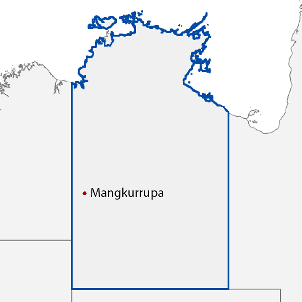
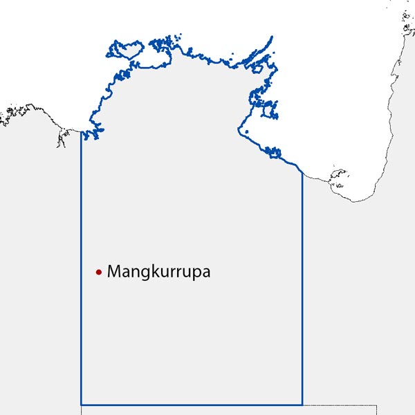
Example: Mangkurrupa is located within the Northern Territory - Outback SA4.
State and Territories
States and Territories are Australia’s 6 states, the Northern Territory and the Australian Capital Territory.
Example: Mangkurrupa is located within the Northern Territory.
Local Government Areas
Local Government Areas (LGAs) are an ABS Mesh Block approximation of gazetted local government boundaries as defined by each state and territory. LGAs cover legally designated parts of a State or Territory for which incorporated local governing bodies have responsibility. Mesh Blocks are allocated to LGAs primarily based on where population is located.
Example: Mangkurrupa is located within the Central Desert LGA.
Regions located inside other regions
Some regions can be surrounded by other regions of the same type. For example, the Australian Capital Territory is surrounded by New South Wales. This can also apply to regions at lower levels of geography. For example, the Alice Springs Indigenous Region (IREG) is surrounded by the Apatula IREG. When a region that completely surrounds another region has been selected, the statistics shown do not include the surrounded region. For example, when the Apatula Indigenous Region is selected, the statistics shown do not include the Alice Springs IREG.